US State Department shows incorrect Africa map at AIDS conference
What's the story
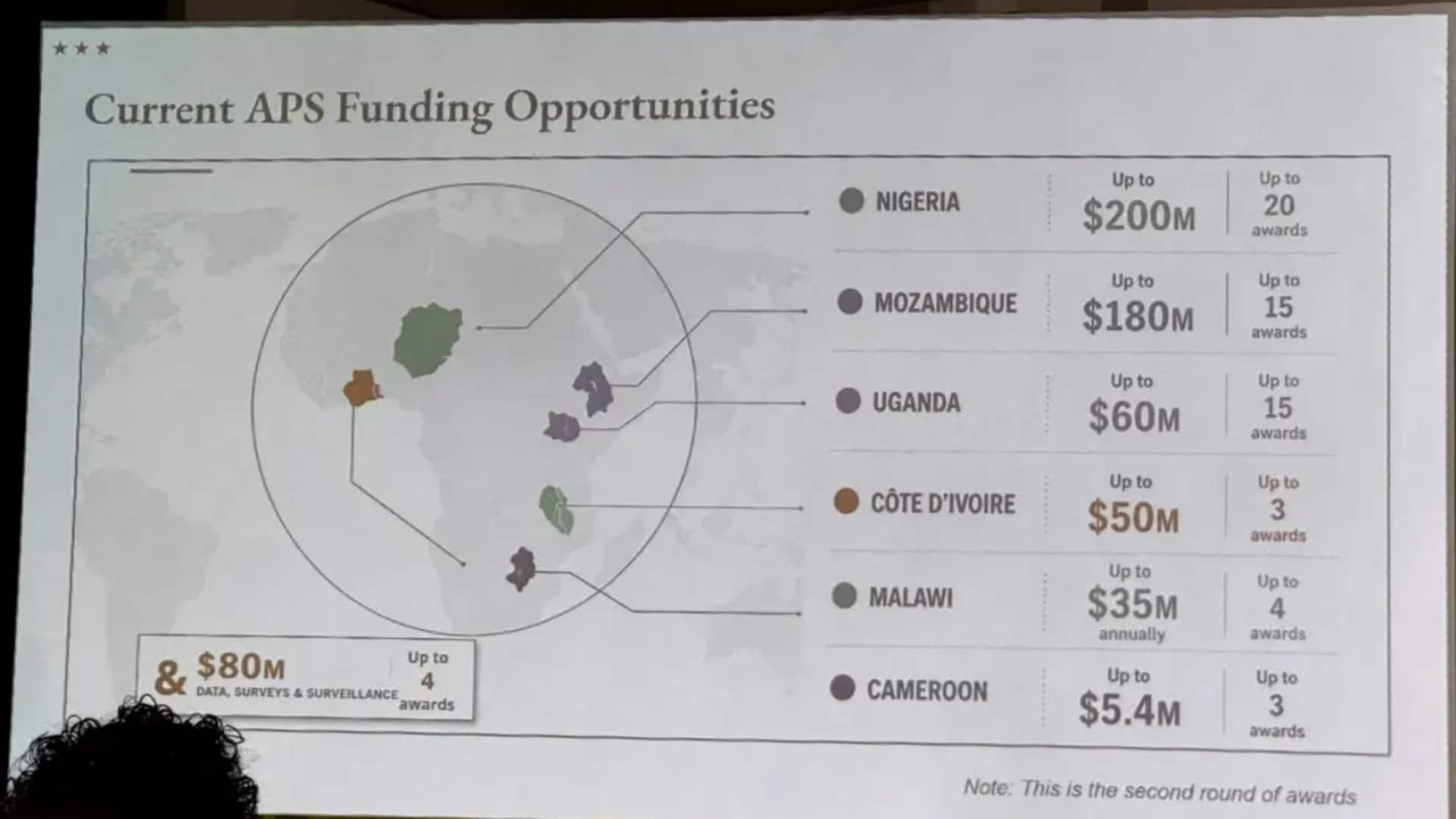
An embarrassing incident occurred at the AIDS 2026 conference in Rio de Janeiro, Brazil, where a United States State Department presentation showed an inaccurate map of Africa. The map incorrectly labeled six African countries: Nigeria, Mozambique, Uganda, Cote d'Ivoire, Malawi, and Cameroon. The errors were glaring: Nigeria was shown as landlocked in the Sahara Desert; Mozambique was misplaced in the Horn of Africa; and Cote d'Ivoire was located on the opposite side of the continent.
Apology issued
State Department takes responsibility for misrepresentation
The US State Department has apologized for the blunder, with a spokesperson saying it was "an unfortunate error" caused by a last-minute edit by a team member.
The department took full responsibility for the confusion and misrepresentation caused to attendees, including African partners.
The speaker at the conference was Jeff Graham, the top US health envoy overseeing President's Emergency Plan for AIDS Relief (PEPFAR).
Criticism voiced
Map errors spark criticism of Trump administration
The map errors have drawn criticism from former US officials, who pointed to staffing challenges at the State Department.
Cameron Hudson, a former official focused on Africa, said on social media that such mistakes are a result of major staff cuts and restructuring under President Donald Trump's administration.
He warned that similar issues could arise in other critical negotiations, like those with Iran over nuclear deals.
Technology used
AI watermark found on erroneous map
Interestingly, an analysis by Reuters found that the erroneous map had an artificial intelligence watermark, indicating it was created using OpenAI tools. The company is currently investigating the report.
Despite the controversy, discussions at AIDS 2026 were described as "substantive and constructive" by the State Department, which said that it remained committed to fighting AIDS with real results.