NASA-ISRO satellite sends first radar images of Earth
What's the story
The National Aeronautics and Space Administration (NASA) and the Indian Space Research Organisation(ISRO) have released the first radar images from their joint Earth-observing satellite, NISAR (NASA-ISRO Synthetic Aperture Radar). Launched on July 30, 2025, the satellite is equipped with advanced L-band and S-band radar systems. The initial images, taken in August, show incredible detail, from dense forests and wetlands to agricultural patterns and urban areas.
Technological advancement
NISAR's unique radar systems
NISAR is the first satellite to carry both L-band and S-band radars, providing complementary capabilities for high-resolution Earth observation. NASA's L-band system can penetrate dense forest canopies, measure soil moisture, and detect minute land movements such as ice shifts, landslides, and tectonic activity. Meanwhile, ISRO's S-band radar is highly sensitive to small vegetation changes in crops, grasslands. Together they allow NISAR to capture natural and human-altered landscapes with unparalleled clarity.
Monitoring potential
NISAR's first image shows land use patterns
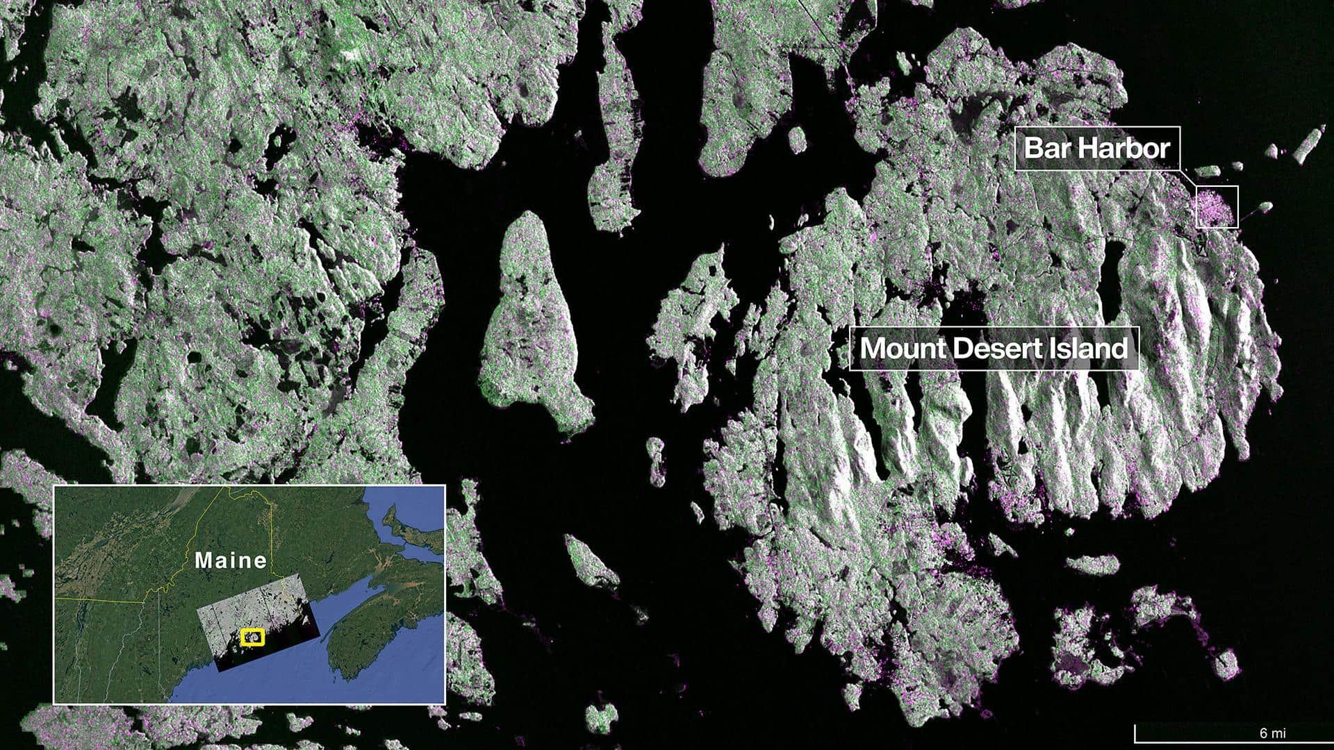
On August 21, NISAR's L-band radar captured Maine's Mount Desert Island, highlighting forests, water bodies, urban infrastructure. The images clearly differentiate between cropland, pastures, natural vegetation. This shows how NISAR's radar capabilities can monitor land use and ecological health with precision. The high-resolution data from NISAR enables detailed analysis of Earth's ecosystems and agricultural productivity over time. Scientists can now track deforestation, wetland loss, crop growth more accurately than ever before.
Disaster response
Early warning for natural disasters
NISAR also offers early warning capabilities for natural disasters such as earthquakes, landslides, flooding. This gives governments and emergency responders time to take action to protect lives infrastructure. The mission represents years of joint technical development programmatic coordination between NASA ISRO spanning spacecraft design radar engineering global ground-station support. With science operations scheduled to begin in November 2025, NISAR is expected to deliver continuous high-quality radar imagery revolutionizing our understanding of Earth's land ecosystems agricultural systems.