UN to vote on adopting map showing Africa's true scale
What's the story
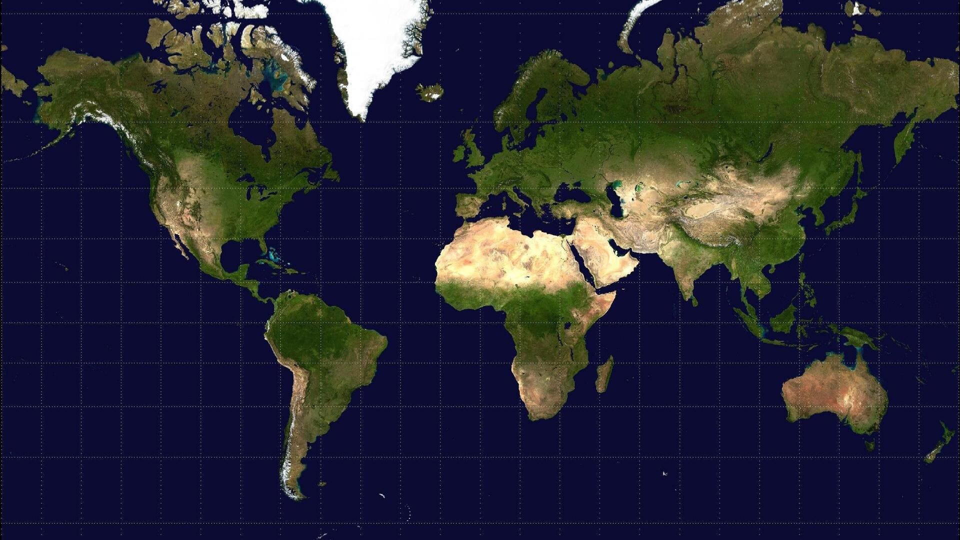
The United Nations General Assembly is set to vote on a resolution on Friday that could replace the traditional Mercator map with a more accurate representation of Africa's size. The resolution, sponsored by Togo and backed by countries including the African Union's 54 other member states, aims to correct the distortions. The map, which still remains the global standard, was created in 1569 by Flemish cartographer Gerardus Mercator for maritime navigation but has since been criticized for misrepresenting land sizes.
Map distortions
Activists' concerns about the map's impact
The Mercator projection makes equatorial regions appear smaller while inflating high-latitude areas.
For instance, Africa appears to be the same size as Greenland on this map, even though it is 14 times larger.
Historians and geographers have long argued that the Mercator projection is based on Western stereotypes, with some using the phrase "cartographic colonialism."
Activists argue that this has influenced global power dynamics by downplaying the presence of the Global South and exaggerating Northern Hemisphere nations.
Map advocacy
#CorrectTheMap campaign and Togo's stance
The #CorrectTheMap campaign by Togo, which has over 11,000 signatures on Change.org, seeks to replace the Mercator projection with the 2018 Equal Earth design.
"You could fit the United States, China, India, Japan, Mexico and much of Europe into Africa and still have land to spare," a petition on Change.org reads.
This design was created by a team of international cartographers and is seen as a way to decolonize global curriculums.
Vote implications
Potential changes and next steps
Togo's Foreign Affairs Minister Robert Dussey emphasized that this discussion is not political but scientific, saying "there is scientific proof so we all have to accept the reality."
While UN resolutions are non-enforceable, if the vote passes, it could lead to changes in educational curricula and technologies that use the Mercator projection.
Togolese authorities are planning an event with UNESCO and tech companies like Google Maps next year to map out the implementation of the resolution if it passes.