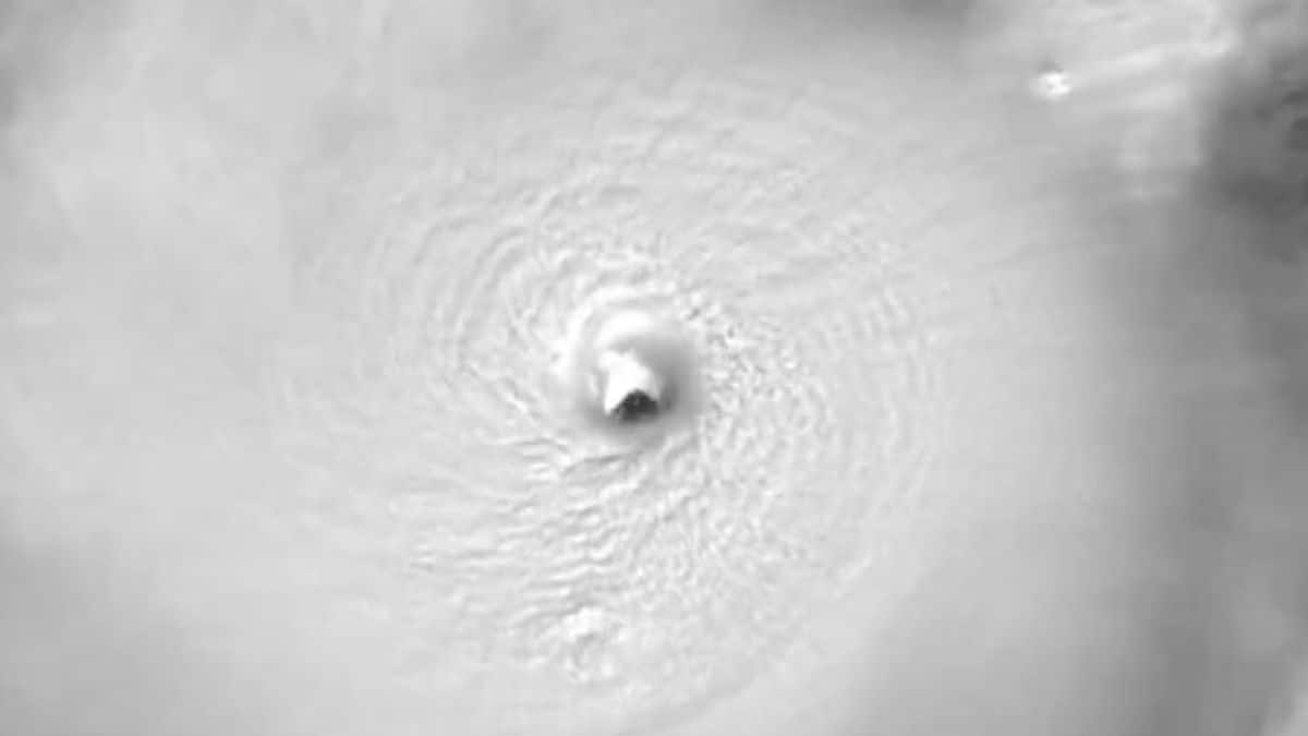
Watch: Hurricane Milton's rapid intensification into Category 5 cyclone
What's the story
Hurricane Milton has quickly intensified into a Category 5 cyclone, with wind speeds reaching up to 282km/h, the National Hurricane Service reported. The hurricane is now headed toward Florida, and residents are facing imminent threat from this powerful hurricane. Meteorologist Levi Cowan wrote online that Milton "is unfortunately hitting the top-end of possible intensification rates," having jumped from a Category 1 to 5 in under a day.
Twitter Post
Take a look at the Milton's footage
A jaw-dropping, high resolution view of Hurricane Milton's powerful, small eye.
— CIRA (@CIRA_CSU) October 7, 2024
This 30-second imagery from GOES-19 is preliminary and non-operational. pic.twitter.com/ExfO6zDbD6
Storm trajectory
It could be the worst storm in Tampa's history
Satellite footage from the National Oceanic and Atmospheric Administration (NOAA) weather satellites has captured Milton's robust windup and growth. The storm is projected to make landfall on the west coast of the Florida peninsula on Wednesday, tracking toward the densely populated Tampa Bay region. The National Weather Service warned that "If the storm stays on the current track, it will be the worst storm to impact the Tampa area in over 100 years."
Unprecedented escalation
Milton's rapid intensification surpasses typical hurricane behavior
Tropical storms, particularly strong hurricanes, can take advantage of conducive environmental conditions to intensify quickly. This usually means an increase in wind speed by about 56km/h or 30 knots in 24 hours. But Milton has gone beyond that. NBC News meteorologist Kathryn Prociv wrote online, "There is such a thing as 'extreme rapid intensification' and #Milton has done it," adding, "Extreme RI defined as a 58mph+ [93km/h+] increase in 24 hours. Milton has gone 90mph [145km/h]."
Twitter Post
From tropical storm to Category 5 hurricane
Minimal tropical storm to category 5 hurricane in less than 48 hours.
— Dr. Kim Wood (@DrKimWood) October 7, 2024
60 kt of intensification in 12 hours alongside a 63-mb drop in pressure.
Milton is in the top 10 for the Atlantic record spanning 1851-2023. pic.twitter.com/NVFKl5uQgJ
Storm catalysts
Warm sea surface temperatures fuel strong hurricanes
Several factors contribute to the formation of strong hurricanes, such as opposing winds that can break apart storms and varying air moisture levels. But a key factor is warm sea surface temperatures above 80°F (27°C). These warm oceans serve as jet fuel for hurricanes, as they cause more water to evaporate into the air, giving storms the energy and moisture to intensify. Today, Atlantic hurricanes are already twice as likely to develop from a milder storm into a major hurricane.
Evacuation orders
Florida residents evacuate as Milton approaches
After the deadly Hurricane Helene, some Florida residents are now evacuating for the second time in weeks. Florida's emergency management division ordered mandatory evacuations for several low-lying areas. The National Hurricane Center (NHC) warned of a significant storm surge for Florida's west coast beginning Tuesday night or early Wednesday, and said Tampa—a metropolitan area of over three million people—could experience an influx of water between eight and 12 feet (2.4 to 3.6 meters) above ground level.
Emergency response
State of emergency declared ahead of Milton's arrival
As efforts to clear damage from Helene before Milton's arrival continue, Governor Ron DeSantis has declared 51 Florida counties under state of emergency. "We need as much of this debris picked up as possible," DeSantis told a press conference. "This creates a safety hazard, and it also will increase the damage that Milton could do with flying debris." Emergency workers are still grappling with relief efforts in the aftermath of Helene, which claimed at least 230 lives in US southeast.